Trail to the waterfalls

Antholz Valley
Add to favourites
Category
Difficulty
Easy
Duration
1:18
in hours
Distance
3.8
in km
Status
closed
Suggested period
Jan
Feb
Mar
Apr
May
Jun
Jul
Aug
Sep
Oct
Nov
Dec

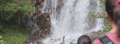
From Antholz Mittertal (sports area) > farm Eggerhöfe > at the bridge starts the trail to the Egger waterfall > back to the farm Egger > path n. 3 to the Klammbach waterfall > on the same way back to the starting point

Route data
Easy
Distance
3,8 km
Duration
1 h 18 min
Ascent
301 m
Decent
301 m
Physical condition
Scenary
Highest point
1.505 m
Lowest point
1.259 m
How to get there

Arrival by public transport

from train station Valdaora:

  • by bus 431 to the bus stop Anterselva di Mezzo/Centro

>See here for the bus & train timetable

Antholz Valley
Eggerhöfe
Bar / Café / Bistro
Antholz Valley
Waterfall Klammbach
Lakes, cascades
Antholz Valley
waterfall Egger
Lakes, cascades
You might be interested in
Discover related tours
Antholz Valley
Mill path "Tränkabachl"
Distance 1,6 km
Duration 32 min
Ascent 117 m
Decent 0 m
Mittertaler Ochsenalm hut | © Taferner Christian, Tourismusverein Antholzertal
Intermediate
Add to favourites
Antholz Valley
Mittertaler Ochsenalm Hut
Distance 4,4 km
Duration 2 h 30 min
Ascent 811 m
Decent 11 m
Status
closed
Antholz Valley
Walking to the "Alte Goste"
Distance 2,0 km
Duration 45 min
Ascent 81 m
Decent 6 m
Müllerkofl path | © TV Antholzertal, Tourismusverein Antholzertal
Intermediate
Add to favourites
Antholz Valley
Path Müllerkofl
Distance 4,2 km
Duration 1 h 30 min
Ascent 150 m
Decent 150 m
Lake Antholz | © Roter Rucksack, Tourismusverein Antholzertal
Intermediate
Add to favourites
Antholz Valley
Circular nature path at the Lake
Distance 3,4 km
Duration 1 h 30 min
Ascent 79 m
Decent 79 m
Lake Antholz | © Plaickner Josef, Tourismusverein Antholzertal
Intermediate
Add to favourites
Antholz Valley
From Antholz Mittertal to the Lake Antholz
Distance 16,3 km
Duration 5 h 00 min
Ascent 727 m
Decent 727 m
Status
closed