To Sand in Taufers to the starting point of the Waterfalls Reinbach

Antholz Valley
Add to favourites
Category
Difficulty
Intermediate
Duration
2:13
in hours
Distance
33.4
in km
Status
closed
Suggested period
Jan
Feb
Mar
Apr
May
Jun
Jul
Aug
Sep
Oct
Nov
Dec

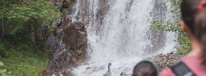
On the Pustertal cycling route from the Antholz Valley to Bruneck and then in direction Ahnrtal to Sand in Taufers to the starting point of the waterfalls Reinbach. From there you can visit the waterfalls on foot.

Route data
Intermediate
Distance
33,4 km
Duration
2 h 13 min
Ascent
318 m
Decent
544 m
Physical condition
Scenary
Highest point
1.108 m
Lowest point
819 m
How to get there

Anterselva di Sotto

You might be interested in
Discover related tours
Antholz Valley
Pustertal Valley Bike Route
Distance 61,9 km
Duration 4 h 19 min
Ascent 468 m
Decent 878 m
Status
closed
Walk through the village of San Candido | © Kottersteger Manuel - TV Antholzertal
Intermediate
Add to favourites
To Innichen
Distance 25,3 km
Duration 1 h 46 min
Ascent 312 m
Decent 168 m
Status
closed
Bruneck | © TV Antholzertal, Tourismusverein Antholzertal
Intermediate
Add to favourites
Antholz Valley
To Ried - Castle Lamprechtsburg and to Bruneck
Distance 24,2 km
Duration 1 h 57 min
Ascent 801 m
Decent 801 m
Status
closed
Antholz Valley
To St. Jakob in Defereggental (AUT)
Distance 37,9 km
Duration 3 h 24 min
Ascent 1.656 m
Decent 1.383 m
Status
closed
Biotope, family | © Notdurfter Anna
Intermediate
Add to favourites
To the Biotope Rasner Möser
Distance 12,4 km
Duration 1 h 08 min
Ascent 116 m
Decent 116 m
Status
closed
Bike trail Val Pusteria | © Alex Filz, Tourismusverein Antholzertal
Intermediate
Add to favourites
Antholz Valley
Pustertal Valley bike route to Mühlbach
Distance 37,4 km
Duration 2 h 33 min
Ascent 772 m
Decent 1.035 m
Status
closed